Singapore
June 2015
San Andreas is a 2015 American 3D disaster film directed by Brad Peyton. Now showing at major cinemas in Singapore, it stars Dwayne (The Rock) Johnson and Paul Giamatti.

(Source: Masti Movie)
California Institute of Technology (Caltech) seismologist Lawrence Hayes (Giamatti) discovers the accuracy of his earthquake prediction model when an unknown fault ruptures near the Hoover Dam, starting a series of earthquakes along the San Andreas Fault. Johnson plays Ray, a Los Angeles Fire Department helicopter rescue pilot whose family is caught in the series of earthquakes in downtown San Francisco.


(Source: Free Press Journal)
San Andreas Fault
This is real.

The San Andreas Fault, the major fault line running through California, is a continental transform fault that extends roughly 1300 km (810 miles) through California. It forms the tectonic boundary between the Pacific Plate and the North American Plate. The fault divides into three segments, each with different characteristics and a different degree of earthquake risk, the most significant being the southern segment, which passes within about 56 km of Los Angeles. The San Andreas Fault is expected to be the source for the "Big One". It has on average a major earthquake every 150 years, but the southernmost segment has not had one since 1680, over 300 years ago. This is why seismologists believe that a major earthquake is overdue.

The central segment of the San Andreas fault runs in a northwestern direction from Parkfield to Hollister. While the southern section of the fault and the parts through Parkfield experience earthquakes, the rest of the central section of the fault exhibits a phenomenon called aseismic creep, where the fault slips continuously without causing earthquakes. That is mainly because the creeping section slowly and continuously moves, while the locked Northern and Southern sections remain locked. These stuck sections of the fault store energy like springs, slowly building up strain. When they suddenly unzip and slide past one another, a massive earthquake occurs.
 Plates at our planet’s surface move because of the intense heat in the Earth’s core that causes molten rock in the mantle layer to move. It moves in a pattern called a convection cell that forms when warm material rises, cools, and eventually sink down. As the cooled material sinks down, it is warmed and rises again.
Most geologic activity stems from the interplay where the plates meet or divide. The movement of the plates creates three types of tectonic boundaries: convergent, where plates move into one another; divergent, where plates move apart; and transform, where plates move sideways in relation to each other.

On land, giant troughs such as the Great Rift Valley in Africa form where plates are tugged apart. If the plates there continue to diverge, millions of years from now eastern Africa will split from the continent to form a new landmass. A mid-ocean ridge would then mark the boundary between the plates.

If one of the colliding plates is topped with oceanic crust, it is forced down into the mantle where it begins to melt. Magma rises into and through the other plate, solidifying into new crust. Magma formed from melting plates solidifies into granite, a light colored, low-density rock that makes up the continents, forming continental crust made of granite, while at the same time, destroying oceanic crust.
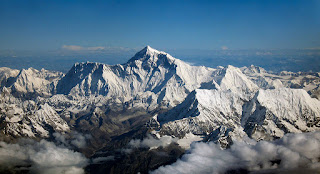
An example of a convergent boundary is when India and Asia crashed about 55 million years ago, slowly giving rise to the Himalayas, the highest mountain system on Earth. At ocean-ocean convergences, where one plate usually dives beneath the other, deep trenches like the Mariana Trench in the North Pacific Ocean, the deepest point on Earth, are formed. These types of collisions can also lead to underwater volcanoes that eventually build up into island arcs like Japan.
The San Andreas Fault in California is an example of a transform boundary, where two plates grind past each other along what are called strike-slip faults. These boundaries do not produce spectacular features like mountains or oceans, but the halting motion often triggers large earthquakes, such as the 1906 one that devastated San Francisco.

Aerial photo of the San Andreas Fault in the Carrizo Plain, a large enclosed grassland plain,
San Luis Obispo County, 160 km northwest of Los Angeles...
(Source: Wikipedia)
The San Andreas Fault, the major fault line running through California, is a continental transform fault that extends roughly 1300 km (810 miles) through California. It forms the tectonic boundary between the Pacific Plate and the North American Plate. The fault divides into three segments, each with different characteristics and a different degree of earthquake risk, the most significant being the southern segment, which passes within about 56 km of Los Angeles. The San Andreas Fault is expected to be the source for the "Big One". It has on average a major earthquake every 150 years, but the southernmost segment has not had one since 1680, over 300 years ago. This is why seismologists believe that a major earthquake is overdue.

(Source: Water Replenishment District)
The central segment of the San Andreas fault runs in a northwestern direction from Parkfield to Hollister. While the southern section of the fault and the parts through Parkfield experience earthquakes, the rest of the central section of the fault exhibits a phenomenon called aseismic creep, where the fault slips continuously without causing earthquakes. That is mainly because the creeping section slowly and continuously moves, while the locked Northern and Southern sections remain locked. These stuck sections of the fault store energy like springs, slowly building up strain. When they suddenly unzip and slide past one another, a massive earthquake occurs.
What Are Plates?
Plate tectonics is the theory that Earth's outer shell is divided into several plates that glide over the mantle, the rocky inner layer above the core. The plates act like a hard and rigid shell compared to Earth's mantle. This strong outer layer is called the lithosphere. From the deepest ocean trench to the tallest mountain, plate tectonics explains the features and movement of Earth's surface in the present and the past.
(Source: Wikipedia)

(Source: Ocean Explorer)
Divergent Boundaries
A divergent boundary occurs when two tectonic plates move away from each other. Along these boundaries, lava spews from long fissures and geysers spurt super-heated water. Frequent earthquakes strike along the rift. Beneath the rift, magma - molten rock - rises from the mantle. It oozes up into the gap and hardens into solid rock, forming new crust on the torn edges of the plates. Magma from the mantle solidifies into basalt, a dark, dense rock that underlies the ocean floor. With this, oceanic crust, made of basalt, is created at divergent boundaries.On land, giant troughs such as the Great Rift Valley in Africa form where plates are tugged apart. If the plates there continue to diverge, millions of years from now eastern Africa will split from the continent to form a new landmass. A mid-ocean ridge would then mark the boundary between the plates.
(Source: msafiri)
Convergent Boundaries
At a convergent boundary, the impact of the two colliding plates buckles the edge of one or both plates up into a rugged mountain range, and sometimes bends the other down into a deep seafloor trench. A chain of volcanoes often forms parallel to the boundary, to the mountain range, and to the trench. Powerful earthquakes shake a wide area on both sides of the boundary.If one of the colliding plates is topped with oceanic crust, it is forced down into the mantle where it begins to melt. Magma rises into and through the other plate, solidifying into new crust. Magma formed from melting plates solidifies into granite, a light colored, low-density rock that makes up the continents, forming continental crust made of granite, while at the same time, destroying oceanic crust.
An example of a convergent boundary is when India and Asia crashed about 55 million years ago, slowly giving rise to the Himalayas, the highest mountain system on Earth. At ocean-ocean convergences, where one plate usually dives beneath the other, deep trenches like the Mariana Trench in the North Pacific Ocean, the deepest point on Earth, are formed. These types of collisions can also lead to underwater volcanoes that eventually build up into island arcs like Japan.

(Source: Wikipedia)
Transform Boundaries
A transform plate boundary when two plates slide past each other. Rocks that line the boundary are pulverized as the plates grind along, creating a linear fault valley or undersea canyon. As the plates alternately jam and jump against each other, earthquakes rattle through a wide boundary zone. In contrast to convergent and divergent boundaries, no magma is formed. Thus, crust is cracked and broken at transform margins, but is not created or destroyed.The San Andreas Fault in California is an example of a transform boundary, where two plates grind past each other along what are called strike-slip faults. These boundaries do not produce spectacular features like mountains or oceans, but the halting motion often triggers large earthquakes, such as the 1906 one that devastated San Francisco.

(Source: Wikipedia)